Here are a few recommended walks / cycle rides to enjoy straight from the front door of La Ville au Tady (LVT). One of the wonderful things about the cottage is its location set in the beautiful rural Breton countryside, with dozens of minor roads, tracks and footpaths to explore.
Most of the routes are short and fairly simple to follow, but the Tregranteur walk is longer and more complex so you should take an IGN walking map from the bookcase to make sure you don't get lost.
If the walk / cycle has an interactive Google map, you can pan and zoom the map, scroll right to see the expand map symbol. Otherwise, a link is provided to view the Google map.
Route name |
Distance (miles) |
Time walk (h:min) |
Time cycle (h:min) |
Height climbed (ft) |
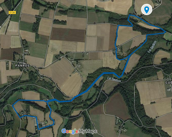
Moulin de Penroc loop |
1 |
0h:20 |
203 |
203 |
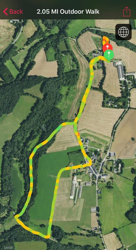
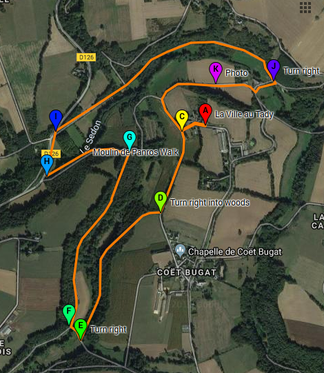
Coet Bugat Lavage |
2.05 |
0h:55 |
284 |
284 |
The three Moulins |
3.85 |
1h:20 |
0h:35 |
351 |
Hidden valley |
5 |
1h:45 |
||
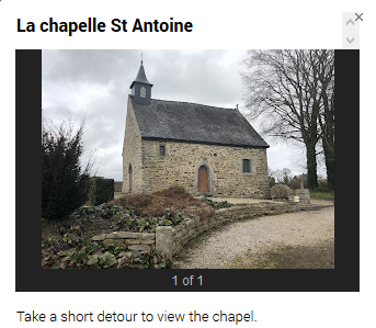
La Chapelle St Antoine |
4 |
1h:30 |
||
Le Bot and Bocabois |
3.15 |
1h:15 |
||
Mesle via Pourmabon |
3.75 |
1hr:20 |
||
Guilleron via Pourmabon |
4.3 |
1h:30 |
0h30 |
400 |
Tregranteur Chateau |
6.85 |
2h:30 |
||
La Roc St Andre, Nante Brest Canal |
15 or 23 |
N/A |
1h:32 or 2hr:32 |
|
|
Walk / cycle - Moulin de Penroc loop
|
|
Walk / cycle to Coet Bugat lavage
|

|
Walk / off road cycle - The three Moulins
|
|
Walk - Hidden Valley
|
|
Walk / cycle - La chapelle St Antoine
|
|
|
Walk / cycle - Le Bot and Bocabois
|
|
|
Cycle / walk - Mesle via Pourmabon
|
|
|
Cycle / walk - Guilleron
|
|
Click on the map to pan/zoom.
|
Walk / cycle - Tregranteur Chateau
|

|
Cycle - Saint Gobrien to Le Roc St Andre
|
If you prefer, you can create your own route using the network of minor roads, tracks and paths in the area. If you want a longer walk, you can sometimes combine a couple of the shorter loops listed above to create one. We provide the local IGN walking map of the area at the cottage for you to explore further. The possibilities are vast, as you will see from the copy of the IGN map below.
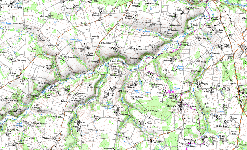
Click the map to expand to full size